Weather and FEMA officials were convinced of the seriousness of Sandy and municipal officials in New York paid heed. They made continual announcements on the media for a couple of days before Sandy was predicted to hit, warning people of high winds, heavy rains – up to 4 inches – and a storm surge. Folks here had heard that before. Hurricane Irene arrived a year ago and failed to live up to its billing so New Yorkers were skeptical about the warnings this time.
As the hours went by and it was clear that Sandy was coming ashore in the New York vicinity, the messages changed from rain and winds to the impact of the likely storm surge, a concept that was not really understood by many in the City or outer boroughs. The warnings were for wide spread flooding as the surge pushed by Sandy, the highest tides of the year and outflow from the Hudson River all came together every 12 hours.
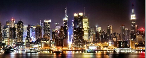
If you stand on the waterfront at Battery Park at the south end of Manhattan and the junction of the East and Hudson River, the water level at high tide is usually about 4-6 feet below the boardwalk. The storm surge was predicted to raise this level by 8 to 11 feet. And as predicted, the high tide and surge came together about 6 o’clock on Monday nite. Along with these were winds at the Battery of 60 – 70 miles per hour.
In the Battery and adjacent financial district, there are road and subway tunnel opening and subway entrances that are completely unprotected. MTA did its best with the subway entrances but they were overwhelmed. Stretching up both rivers are low areas with major roads and a lot of warehousing and housing. Manhattan rises up a spine down the middle so most of this area is not as exposed. The lower areas, which the Mayor ordered evacuated were not so lucky.
As the surge built, water began to come over the waterfront board walks. The lower deck of the two deck FDR highway down the East River was 5 feet under water in places before the surge really built. No one expected this. The water came over the boardwalks on the Hudson River up as far as 20th Street. No one expected this. At its height the surge is reported to have crested the waterfront by 4 to 5 feet. As I reported earlier, the western edges of Chelsea, the West Village and Tribeca had 5 feet of water in the streets. No one expected this.
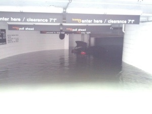
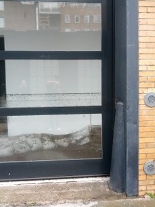
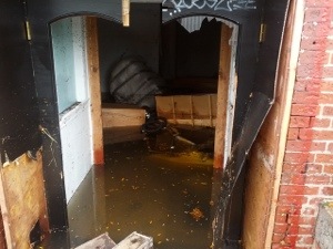
By Tuesday morning most of the water in the streets was gone. However, a couple of the pictures attached show the lingering impacts. Water marks 4 feet up outside and inside walls of many buildings, flooded basements and underground lots filled to the top. Almost all of the tunnels from lower Manhattan to New Jersey and Brooklyn affected by salt water. A bad mix for electrical systems controlling traffic and trains. It will be weeks and many billions to repair this. Measures to prevent this from happening again next time will be gazillions!
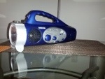
Power has started to return to Manhattan. The financial district went up Wednesday morning and some small spots have been restored. The balance of the City between 25th Street and the financial district is scheduled to come up Thursday afternoon and Friday morning. We are in that group. In the meantime, our lifeline to the outside is our rocket radio/fan/flashlight.
A few buses returned yesterday, no fare until the system is mostly repaired. More stores are opening in the powered areas. This morning they were taking the rotting produce and meat out of Trader Joe’s down the street. The girls have gone find a place to get their hair washed and dried. Life takes a turn toward normalcy.
We have more pictures of the damage but little capacity to get them up. Hope you enjoy these. They are taken along the Hudson River in west Chelsea. Note the water lines on the windows and walls and the car floating in the flooded parking lot.
Cheers for now.
href=”https://kenbayne.com/wp-content/uploads/2012/11/20121101-103413.jpg”>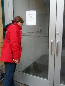


